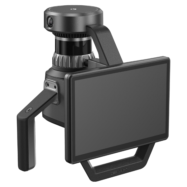
Portable 3D Hand-held LiDAR
We implement digital twins through precise spatial measurement and data collection.
the Real and Virtual Worlds
DIMENVUE

Deep In Sight’s portable 3D spatial information scanner, DIMENVUE, is a powerful solution
that dramatically enhances design precision and construction quality across a wide range of industries
including construction, manufacturing, and civil engineering.
By combining high-performance LiDAR and high-resolution RGB sensors with onboard AI software,
the device enables real-time acquisition of high-density PCD, helping reduce project time and costs.
Equipped with an intuitive interface and touch-based controls,
DIMENVUE is designed for ease of use even in complex field environments,
maximizing productivity and accessibility for all users.

in Industrial Equipment and Machinery
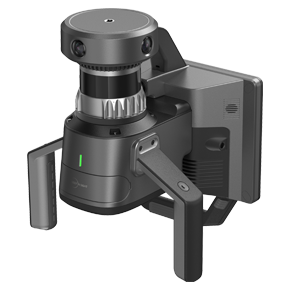
DIMENVUE Pro is a portable 3D spatial scanning solution based on handheld LiDAR technology,
recognized for its outstanding innovation and technological excellence with a CES 2025 Innovation Awards.
Optimized for ease of use across various industries, DIMENVUE Pro is widely applicable not only on construction sites,
but also in smart city development, infrastructure maintenance, cultural heritage restoration, and facility management,
any field that demands highly accurate spatial information.
By leveraging LiDAR, RGB, and IMU sensors,
we deliver highly accurate 3D modeling for construction sites.
The system operates reliably in both indoor and outdoor environments,
and its lightweight design enables users to easily capture complex spatial data
within just a few minutes.
AI-powered real-time object recognition and segmentation
automatically classify scanned data and remove unnecessary elements.
This significantly reduces time and cost during design and construction processes,
enabling more precise utilization of 3D data.
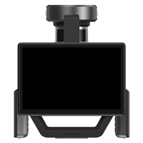
Equipped with a high-resolution display and an intuitive interface,
the system enables users to easily view real-time 3D data.
An ergonomic design is also applied to minimize user fatigue and enhance overall usability.
With AI-powered spatial scanning technology,
data is processed in real time directly on the device.
This eliminates the need for external storage or additional post-processing,
reducing operation time and enhancing security.
Equipped with a high-performance LiDAR sensor, multi-camera system, and AI-based edge device,
it captures precise spatial structures and generates optimized 3D data even in complex environments.
-
- Weight
- 2.7kg
- Dimensions
- 192 x 148 x 433 (mm)
- Storage Capacity
- 512 GB SSD
- Operating Time
- 1.5 hours
- Camera Resolution
- 48 MP x 2
-
- Interface
- USB 3.1 Gen 2
- Battery Voltage
- 14.4V
- Battery Capacity
- 46.8Wh
- PCD Format
- .LAS .PLY
- Display
- Smartphone
-
- Image Format
- .JPG
- Accuracy
- (Less than 100 m) ±1 cm
- LiDAR Channels
- 16
- LiDAR FOV
- 360° X 270°
- PCD Acquisition Rate
- ~320,720 points/s

